Tocht Stappen La Chapelle-en-Valgaudémar - 05 La Chapelle en Valgaudemar - Le chapeau  - Photo
 chris13370
chris13370

Gebruiker

© OpenStreetMap contributors
Lengte
Lengte
10,8 km
Max. hoogte
Max. hoogte
2357 m
Positief hoogteverschil
1135 m
Km-Effort
Km-Effort  
26 km
Min. hoogte
Min. hoogte
1308 m
Negatief hoogteverschil
1133 m
Boucle
Boucle
Ja
Datum van aanmaak :
2019-01-15 16:54:38.32
Laatste wijziging :
2019-01-15 16:54:38.32

(0 Bericht)

Stappen
Stappen
6h56
Moeilijkheid : Moeilijk

Scan deze QR-code om de tocht te openen in de SityTrail-applicatie

Gratisgps-wandelapplicatie

Logo SityTrail SityTrail

IGN / Geografische instituten

SityTrail uit de App Store downloaden SityTrail uit Google Play downloaden

Logo SityTrail SityTrail World

De wereld gaat voor u open

SityTrail uit de App Store downloaden SityTrail uit Google Play downloaden SityTrail op Huawei AppGallery downloaden

Over ons

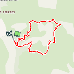
Tocht Stappen van 10,8 km beschikbaar op Provence-Alpes-Côte d'Azur, Hautes-Alpes, La Chapelle-en-Valgaudémar. Deze tocht wordt voorgesteld door chris13370.

Beschrijving

Départ de Navette.
Panorama superbe depuis le Chapeau et pendant toute la montée. Quelques passages en Crête superbes mais exposés pour ceux qui craignent le vertige.
Retour vers la cascade de la Buffe.
La descente demande une vigilance constante.


Hoogteprofiel

Plaatsbepaling

Land:
France
Regio :
Provence-Alpes-Côte d'Azur
Departement/Provincie :
Hautes-Alpes
Gemeente :
La Chapelle-en-Valgaudémar
Locatie:
Unknown
Vertrek:(Dec)
Vertrek:(UTM)
278595 ; 4964353 (32T) N.

Wandeltochten in de omgeving

Tocht Stappen La Chapelle-en-Valgaudémar - Refuge de Chalance - Photo
Stappen
GUIDE
Marco05

Stappen

Moeilijk
(1)
La Chapelle-en-Valgaudémar, Provence-Alpes-Côte d'Azur, Hautes-Alpes, France
7,5 km | 22 km-effort
5h 1min
Ja
Tocht Stappen La Chapelle-en-Valgaudémar - circuit de la cabane de l'aup .08-06-14 - Photo
Stappen
Dervalmarc

Stappen

Heel gemakkelijk
(1)
La Chapelle-en-Valgaudémar, Provence-Alpes-Côte d'Azur, Hautes-Alpes, France
8,8 km | 13,6 km-effort
2h 37min
Ja
Tocht Stappen La Chapelle-en-Valgaudémar - Tour du Vieux Chaillol 2/5 - Du Gîte Le Casset au Refuge de Vallonpierre - Photo
Stappen
tracegps

Stappen

Medium
(1)
La Chapelle-en-Valgaudémar, Provence-Alpes-Côte d'Azur, Hautes-Alpes, France
11,8 km | 24 km-effort
4h 30min
Neen
Tocht Stappen Villar-Loubière - Pic Turbat - Photo
Stappen
GUIDE
Marco05

Stappen

Zeer moeilijk
Villar-Loubière, Provence-Alpes-Côte d'Azur, Hautes-Alpes, France
19,8 km | 46 km-effort
10h 26min
Ja
Tocht Stappen La Chapelle-en-Valgaudémar - Lacs de Pétarel-Col de la Béranne - Photo
Stappen
GUIDE
Marco05

Stappen

Medium
La Chapelle-en-Valgaudémar, Provence-Alpes-Côte d'Azur, Hautes-Alpes, France
11,1 km | 23 km-effort
7h 0min
Ja
Tocht Stappen La Chapelle-en-Valgaudémar - Pas de l'Olan - Photo
Stappen
GUIDE
Marco05

Stappen

Zeer moeilijk
La Chapelle-en-Valgaudémar, Provence-Alpes-Côte d'Azur, Hautes-Alpes, France
12,6 km | 34 km-effort
7h 37min
Ja
Tocht Stappen La Chapelle-en-Valgaudémar - Valgaudemar - La Chapelle (les Portes) forêt - 4.3km 285m 1h35 - 2018 07 05 - public - Photo
Stappen
GUIDE
Orcal37

Stappen

Gemakkelijk
La Chapelle-en-Valgaudémar, Provence-Alpes-Côte d'Azur, Hautes-Alpes, France
4,3 km | 8,1 km-effort
1h 40min
Ja
Tocht Stappen La Chapelle-en-Valgaudémar - Valgaudemar - La Chapelle Vallon de la Navette - 10.9km 420m 3h25 - 2018 06 30 - public - Photo
Stappen
GUIDE
Orcal37

Stappen

Medium
La Chapelle-en-Valgaudémar, Provence-Alpes-Côte d'Azur, Hautes-Alpes, France
10,9 km | 16,4 km-effort
4h 30min
Ja
Tocht Stappen La Chapelle-en-Valgaudémar - Valgaudemar - La Chapelle Vallée de la Séveraisse Refuge du Clot - 15.9km 450m 4h35 - 2018 07 01 - public - Photo
Stappen
GUIDE
Orcal37

Stappen

Medium
La Chapelle-en-Valgaudémar, Provence-Alpes-Côte d'Azur, Hautes-Alpes, France
15,9 km | 22 km-effort
5h 55min
Ja


Sluiten
Mijn abonnementen